Lêer:Bonneville Salt Flats (17423029055).jpg

Oorspronklike lêer (1 280 × 960 piksels, lêergrootte: 196 KG, MIME-tipe: image/jpeg)
.jpg)
Opsomming
| Beskrywing |
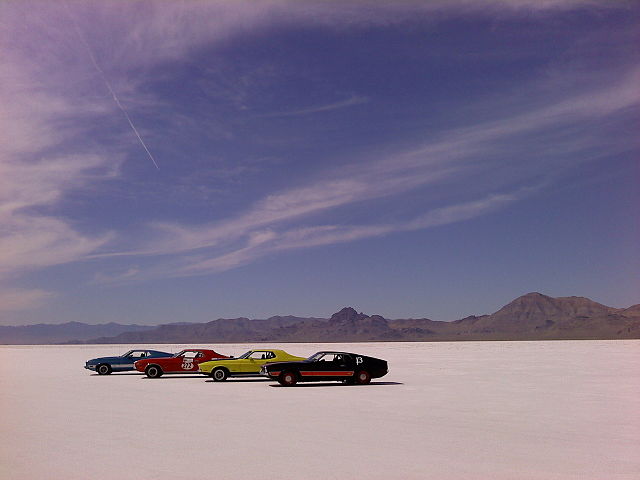
Managed by the BLM as an Area of Critical Environmental Concern and Special Recreation Management Area, the Bonneville Salt Flats are a 30,000 acre expanse of hard, white salt crust on the western edge of the Great Salt Lake basin in Utah. “Bonneville” is also on the National Register of Historic Landmarks because of its contribution to land speed racing. The salt flats are about 12 miles long and 5 miles wide with total area coverage of just over 46 square miles. Near the center of the salt, the crust is almost 5 feet thick in places, with the depth tapering off to less than 1 inch as you get to the edges. Total salt crust volume has been estimated at 147 million tons or 99 million cubic yards of salt! The remote and rugged Bonneville Salt Flats serve as a fitting backdrop forIndependence Day, Pirates of the Caribbean: At World’s End, Con Air, The World’s Fastest Indian, Mulholland Falls, and many more films. The BLM’s Bonneville Salt Flats also attracts amateur racers from all over the world for the annual SPEED WEEK, with timed speed events on 3 to 5 mile straightaway tracks. Learn more about the history of this unique location: on.doi.gov/1EuCmOU Photo courtesy BLM Utah |
| Datum | |
| Bron | Bonneville Salt Flats |
| Outeur | Bureau of Land Management |
Lisensiëring
- U is vry:
- om te deel – die werk kopieer, versprei en deurgee
- om te hermeng – om die werk aan te pas
- Onder die volgende voorwaardes:
- naamsvermelding – U moet die nodige krediet gee, 'n skakel na die lisensie verskaf en aandui of daar veranderinge aangebring is. U mag dit op enige redelike manier doen, maar nie op enige manier wat daarop dui dat die lisensiegewer u of u gebruik onderskryf nie.
| This image was originally posted to Flickr by mypubliclands at https://flickr.com/photos/91981596@N06/17423029055. It was reviewed on 4 Augustus 2015 by FlickreviewR and was confirmed to be licensed under the terms of the cc-by-2.0. |
| This image is a work of a Bureau of Land Management* employee, taken or made as part of that person's official duties. As a work of the U.S. federal government, the image is in the public domain in the United States. *or predecessor organization |
Lêergeskiedenis
Klik op die datum/tyd om te sien hoe die lêer destyds gelyk het.
| Datum/Tyd | Duimnael | Dimensies | Gebruiker | Opmerking | |
|---|---|---|---|---|---|
| huidig | 18:56, 4 Augustus 2015 | | 1 280 × 960 (196 KG) | Wilfredor | Transferred from Flickr via Flickr2Commons |
Lêergebruik
Die volgende bladsy gebruik dié lêer:
.jpg)