Lêer:Botswana Topography.png
Grootte van hierdie voorskou: 638 × 599 piksels. Ander resolusies: 255 × 240 piksels | 511 × 480 piksels | 817 × 768 piksels | 1 090 × 1 024 piksels | 1 440 × 1 353 piksels.
Oorspronklike lêer (1 440 × 1 353 piksels, lêergrootte: 1,78 MG, MIME-tipe: image/png)
Opsomming
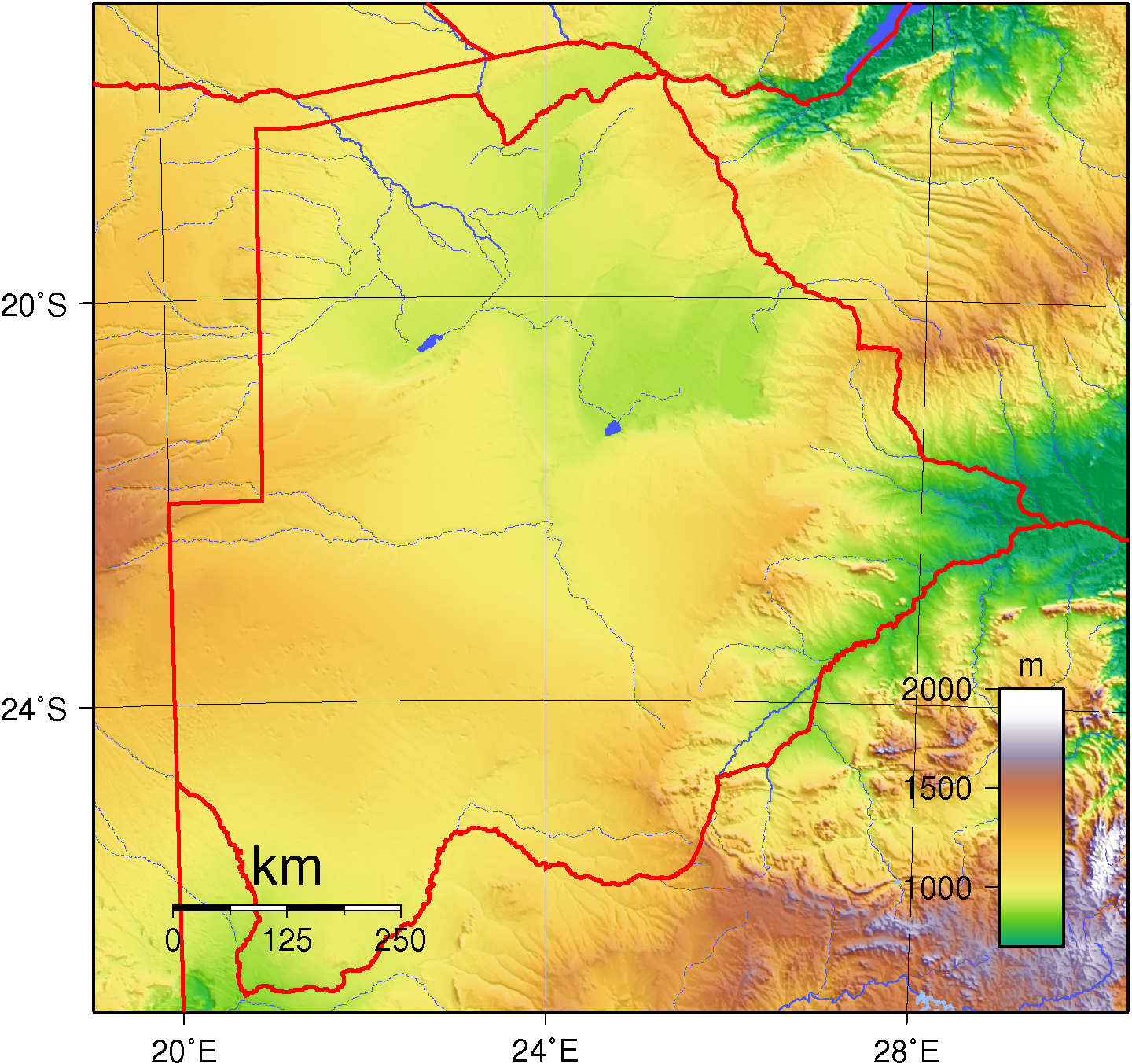
| Beskrywing | Topographic map of Botswana. Created with GMT from public domain GLOBE data |
| Datum | |
| Bron | Eie werk |
| Outeur | Sadalmelik |
Lisensiëring
| This work has been released into the public domain by its author, I, Sadalmelik. This applies worldwide. In sommige lande is dit dalk nie wettiglik moontlik nie. Indien so: I, Sadalmelik grants anyone the right to use this work for any purpose, without any conditions, unless such conditions are required by law. |
Lêergeskiedenis
Klik op die datum/tyd om te sien hoe die lêer destyds gelyk het.
| Datum/Tyd | Duimnael | Dimensies | Gebruiker | Opmerking | |
|---|---|---|---|---|---|
| huidig | 19:08, 29 Junie 2007 | | 1 440 × 1 353 (1,78 MG) | Sadalmelik | Better colours/data |
| 22:04, 21 Junie 2007 |  | 1 440 × 1 353 (1,79 MG) | Sadalmelik | {{Information |Description=Topographic map of Botswana. Created with GMT from public domain GLOBE data |Source=self-made |Date=June 22, 2007 |Author= Sadalmelik }} Category:Maps of Botswana Category:Topographic maps of Africa |
Lêergebruik
Die volgende bladsy gebruik dié lêer:
Globale lêergebruik
Die volgende ander wiki's gebruik hierdie lêer:
- Gebruik in avk.wikipedia.org
- Gebruik in bg.wikipedia.org
- Gebruik in en.wikipedia.org
- Gebruik in es.wikipedia.org
- Gebruik in fa.wikipedia.org
- Gebruik in fr.wikipedia.org
- Gebruik in he.wikipedia.org
- Gebruik in hu.wikipedia.org
- Gebruik in ka.wikipedia.org
- Gebruik in lt.wikipedia.org
- Gebruik in mk.wikipedia.org
- Gebruik in ru.wikipedia.org
- Gebruik in ru.wikimedia.org
- Gebruik in uk.wikipedia.org
- Gebruik in vep.wikipedia.org
- Gebruik in zh.wikipedia.org