Lêer:Map of the North West with Molopo highlighted (2009).svg

Size of this PNG preview of this SVG file: 800 × 553 piksels. Ander resolusies: 320 × 221 piksels | 640 × 442 piksels | 1 024 × 707 piksels | 1 280 × 884 piksels | 2 560 × 1 768 piksels | 912 × 630 piksels.
Oorspronklike lêer (SVG-lêer, normaalweg 912 × 630 piksels, lêergrootte: 391 KG)
.svg)
Opsomming
| Beskrywing |
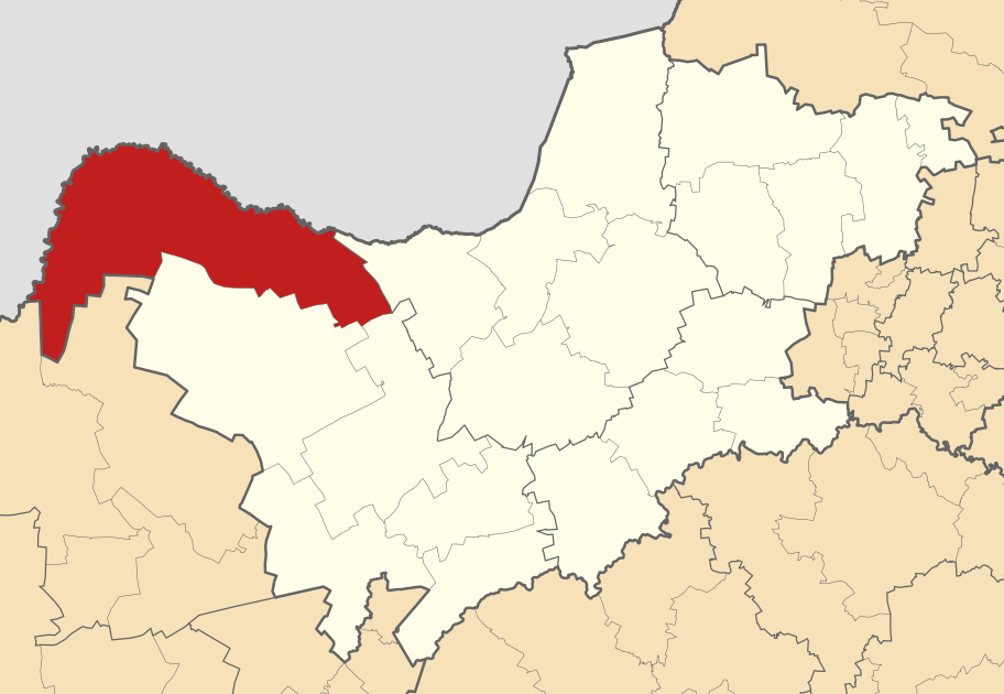
English: Map of the North West with the Molopo Local Municipality highlighted. Based on Image:Blank map of the North West.svg. |
| Datum | |
| Bron | Eie werk |
| Outeur | Htonl |
Lisensiëring
Ek, die outeursreghouer van hierdie werk, publiseer dit onder die volgende lisensie:
Hierdie lêer is gelisensieer onder die Creative Commons Erkenning-Insgelyks Deel 3.0 Onoorgedraagde lisensie.
- U is vry:
- om te deel – die werk kopieer, versprei en deurgee
- om te hermeng – om die werk aan te pas
- Onder die volgende voorwaardes:
- naamsvermelding – U moet die nodige krediet gee, 'n skakel na die lisensie verskaf en aandui of daar veranderinge aangebring is. U mag dit op enige redelike manier doen, maar nie op enige manier wat daarop dui dat die lisensiegewer u of u gebruik onderskryf nie.
- insgelyks – As u die materiaal hermix, transformeer of voortbou, moet u u bydraes versprei onder die dieselfde of versoenbare lisensie as die oorspronklike.

|
Toestemming word verleen tot die kopiëring, verspreiding en/of wysiging van hierdie dokument onder die voorwaardes van die GNU-lisensie vir vrye dokumentasie, weergawe 1.2 of enige latere weergawe uitgegee deur die Stigting vir Vrye Sagteware, sonder Invariante Dele, geen Voorbladtekste en geen Agterbladtekste. 'n Kopie van hierdie lisensie is ingesluit in die afdeling getiteld GNU Free Documentation License. |
U kan die lisensie van u keuse kies.
Lêergeskiedenis
Klik op die datum/tyd om te sien hoe die lêer destyds gelyk het.
| Datum/Tyd | Duimnael | Dimensies | Gebruiker | Opmerking | |
|---|---|---|---|---|---|
| huidig | 02:05, 18 Maart 2011 | | 912 × 630 (391 KG) | Htonl | tweak size |
| 22:29, 20 Desember 2010 |  | 855 × 585 (800 KG) | Htonl | projection, style | |
| 22:13, 2 Februarie 2010 |  | 1 000 × 625 (1,21 MG) | Htonl | == {{int:filedesc}} == {{Information |Description={{en|1=Map of the North West with the Molopo Local Municipality highlighted. Based on Image:Blank map of the North West.svg.}} |Source={{own}} |Author=Htonl |Date=2010-02-01 |Permission |
Lêergebruik
Die volgende bladsy gebruik dié lêer:
Globale lêergebruik
Die volgende ander wiki's gebruik hierdie lêer:
- Gebruik in de.wikipedia.org
- Gebruik in en.wikipedia.org
- Gebruik in nl.wikipedia.org
- Gebruik in pl.wikipedia.org
- Gebruik in ru.wikipedia.org
- Gebruik in www.wikidata.org
- Gebruik in yo.wikipedia.org
- Gebruik in zu.wikipedia.org
.svg)