Lêer:-conservationlands15 Social Media Takeover, Jan 15th, Rio Grande Wild and Scenic River in New Mexico (16287782645).jpg

Oorspronklike lêer(3 890 × 2 500 piksels, lêergrootte: 6,27 MG, MIME-tipe: image/jpeg)

Hierdie lêer kom vanaf Wikimedia Commons en kan ook in ander projekte gebruik word. Die beskrywing op die lêer se inligtingsblad word hieronder weergegee.

Opsomming

Beskrywing

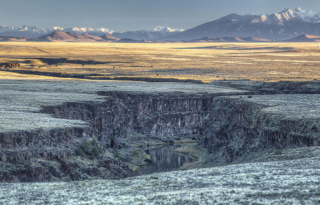
January's #nationalconservationlands Top 15: National Conservation Lands Milestones

Each #conservationlands15 month will feature a Top 15 list. Today’s Top 15 puts the National Conservation Lands in perspective - from our history to our future.

  1. 1 National Wild and Scenic Rivers Act is enacted into law, designates two BLM-managed Wild and Scenic Rivers (Rio Grande and Rogue); now, the BLM manages 69 such rivers — 1968.
  1. 2 The Pacific Crest National Scenic Trail is one of two trails designated within the newly-minted National Trails System Act; now, the BLM has stewardship responsibilities for segments of 18 National Scenic and Historic Trails — 1968.
  1. 3 King Range, on California’s rugged Lost Coast, is designated as the nation’s first National Conservation Area; today, the BLM manages 21 National Conservation Areas and Similar Designations — 1970.
  1. 4 Federal Land Policy and Management Act enacted; establishes California Desert Conservation Area and directs the BLM to study lands under its stewardship for wilderness values — 1976.
  1. 5 The BLM study process identifies Wilderness Study Areas for consideration by Congress for Wilderness designation; the BLM currently manages 588 Wilderness Study Areas - 1980.
  1. 6 Yaquina Head in Oregon, including its stately lighthouse, is designated as the first Outstanding Natural Area to be managed by the BLM; today, there are five lighthouses located on National Conservation Lands - 1980.
  1. 7 Montana’s Beartrap Canyon is designated as the first BLM wilderness; the BLM currently administers 221 wilderness areas — 1983.
  1. 8 Congress creates the San Pedro River National Conservation Area in southern Arizona; in 1995, the American Bird Conservancy recognized the San Pedro as its first “globally important bird area” in the U.S. — 1988.
  1. 9 Utah’s Grand Staircase-Escalante is designated the BLM’s first national monument by President Bill Clinton; today, the BLM manages 20 national monuments — 1996.
  1. 10 Secretary of Interior Bruce Babbitt establishes the “National Landscape Conservation System,” now commonly referred to as the National Conservation Lands — 2000.
  1. 11 First National Conservation Lands Science Grants are issued; to date, the program has funded a total of 182 science projects, nearly all for universities, non-profit research organizations, and other partners — 2000.
  1. 12 Congress votes the National Landscape Conservation System into law to “conserve, protect, and restore nationally significant landscapes that have outstanding cultural, ecological, and scientific values for the benefit of current and future generations” — 2009.
  1. 13 The 10th anniversary of the National Landscape Conservation System is celebrated with more than 90 BLM events from coast to coast; a new 15-year strategy for management of BLM conservation lands is established — 2010.
  1. 14 Arizona’s Grand Canyon-Parashant National Monument is recognized as the first International Dark Sky Province on BLM-managed lands — 2014.
  1. 15 The National Conservation Lands celebrate their 15th anniversary as a system: 878 units totaling 31 million acres in 13 states! — 2015.
Photo of Rio Grande Wild and Scenic River, New Mexico, by Bob Wick
Datum
Bron #conservationlands15 Social Media Takeover, Jan 15th, Rio Grande Wild and Scenic River in New Mexico
Outeur Bureau of Land Management

Lisensiëring

w:af:Creative Commons
naamsvermelding
This file is licensed under the Creative Commons Attribution 2.0 Generic license.
U is vry:
  • om te deel – die werk kopieer, versprei en deurgee
  • om te hermeng – om die werk aan te pas
Onder die volgende voorwaardes:
  • naamsvermelding – U moet die nodige krediet gee, 'n skakel na die lisensie verskaf en aandui of daar veranderinge aangebring is. U mag dit op enige redelike manier doen, maar nie op enige manier wat daarop dui dat die lisensiegewer u of u gebruik onderskryf nie.
This image was originally posted to Flickr by mypubliclands at https://flickr.com/photos/91981596@N06/16287782645. It was reviewed on 4 Augustus 2015 by FlickreviewR and was confirmed to be licensed under the terms of the cc-by-2.0.

4 Augustus 2015

Public domain This image is a work of a Bureau of Land Management* employee, taken or made as part of that person's official duties. As a work of the U.S. federal government, the image is in the public domain in the United States.
*or predecessor organization

Captions

Add a one-line explanation of what this file represents

Items portrayed in this file

uitbeelding

MIME type Engels

image/jpeg

checksum Engels

132dff5458d2371871f3d1183478edc97a422317

data size Engels

6 572 425 greep

height Engels

2 500 pieksel

width Engels

3 890 pieksel

Lêergeskiedenis

Klik op die datum/tyd om te sien hoe die lêer destyds gelyk het.

Datum/TydDuimnaelDimensiesGebruikerOpmerking
huidig19:15, 4 Augustus 2015Duimnaelskets vir weergawe vanaf 19:15, 4 Augustus 20153 890 × 2 500 (6,27 MG)WilfredorTransferred from Flickr via Flickr2Commons

Die volgende bladsy gebruik dié lêer:

Metadata