Lêer:Ancient Orient.png

Grootte van hierdie voorskou: 800 × 516 piksels. Ander resolusies: 320 × 206 piksels | 640 × 413 piksels | 1 024 × 661 piksels | 1 280 × 826 piksels | 2 560 × 1 652 piksels | 4 365 × 2 816 piksels.
Oorspronklike lêer (4 365 × 2 816 piksels, lêergrootte: 10,18 MG, MIME-tipe: image/png)
Opsomming
| Beskrywing |
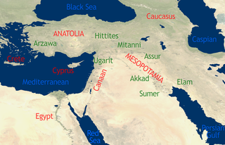
English: See Image:Orient 27 43 22 55 blank map.png for a blank map.
self-created in November 2004 on the basis of the 2002 NASA Blue Marble image.[1] |
| Datum | 15 November 2004 (original upload date) |
| Bron | This compound image uses free material land_shallow_topo_east.tif from NASA Visible Earth (formerly "Blue Marble") and world.200407.3x21600x21600.C1.png from JULY, BLUE MARBLE NEXT GENERATION |
| Outeur | Dbachmann and Cush at en.wikipedia |
Lisensiëring
For the current map
| This work has been released into the public domain by its author, Cush. This applies worldwide. In sommige lande is dit dalk nie wettiglik moontlik nie. Indien so: |
For the previous map
| This work has been released into the public domain by its author, Dbachmann at Engels Wikipedia. This applies worldwide. In sommige lande is dit dalk nie wettiglik moontlik nie. Indien so: Dbachmann grants anyone the right to use this work for any purpose, without any conditions, unless such conditions are required by law. |
Oorspronklike oplaailogboek
The original description page was here. All following user names refer to en.wikipedia.
- 2004-11-15 08:40 Dbachmann 429×274×8 (213130 bytes) {{PD}}
Lêergeskiedenis
Klik op die datum/tyd om te sien hoe die lêer destyds gelyk het.
| Datum/Tyd | Duimnael | Dimensies | Gebruiker | Opmerking | |
|---|---|---|---|---|---|
| huidig | 13:34, 22 Oktober 2010 | | 4 365 × 2 816 (10,18 MG) | Cush | Enhanced and enlarged version with city names and locations. Unfortunately the map had to be scaled to 88% of the original (due to size constraints on WP) so that the city labels are a little blurred. |
| 13:25, 22 Oktober 2010 |  | 429 × 274 (208 KG) | Cush | restored previous version, grrr | |
| 13:19, 22 Oktober 2010 |  | 4 960 × 3 200 (12,11 MG) | Cush | Enhanced and enlarged version with city names and locations | |
| 01:25, 25 Julie 2008 |  | 429 × 274 (208 KG) | File Upload Bot (Magnus Manske) | {{BotMoveToCommons|en.wikipedia}} {{Information |Description={{en|see en::Image:Orient 27 43 22 55 blank map.png for a blank map. self-created in November 2004 on the basis of the 2002 NASA en:Blue Marble image.[http://earthobservatory.nasa. |
Lêergebruik
Die volgende bladsy gebruik dié lêer:
Globale lêergebruik
Die volgende ander wiki's gebruik hierdie lêer:
- Gebruik in am.wikipedia.org
- Gebruik in ar.wikipedia.org
- Gebruik in arz.wikipedia.org
- Gebruik in be-tarask.wikipedia.org
- Gebruik in be.wikipedia.org
- Gebruik in bn.wikipedia.org
- Gebruik in ca.wikipedia.org
- Gebruik in cs.wikipedia.org
- Gebruik in en.wikipedia.org
- Talk:Arabic
- Talk:Delian League
- Talk:Adamic language
- Talk:Alyattes of Lydia
- Talk:Bible
- Talk:Biblical canon
- Talk:Books of the Bible
- Talk:Behistun Inscription
- Talk:Battle of Marathon
- Talk:Cassandra
- Talk:Anti-Semitism in Christianity
- Talk:Dragon
- Talk:Epistle of James
- Talk:Book of Genesis
- Talk:Hebrew alphabet
- Talk:History of ancient Israel and Judah
- Talk:Religion in pre-Islamic Arabia
- Talk:Jerusalem
- Talk:Japheth
- Talk:Lucifer
- Talk:New Testament
- Talk:Old Testament
- Talk:Roman Empire
- Talk:Resurrection of Jesus
- Talk:Satan
- Talk:Temple in Jerusalem
- Talk:Names of God in Judaism
- Talk:Great Tribulation
- Talk:Matthias the Apostle
- Talk:Acre, Israel
- Talk:Nevi'im
- Talk:Cambyses II
- Talk:Gospel of Luke
- Talk:Tantalus
- Talk:Semitic languages
- Talk:Kingdom of Kush
- Talk:Zoroastrianism
- Talk:Babylonia and Assyria
- Talk:History of the ancient Levant
- Talk:Judas Iscariot
- Talk:Sherden
Wys meer globale gebruik van die lêer.