Lêer:Clementine albedo simp750.jpg
Grootte van hierdie voorskou: 800 × 400 piksels. Ander resolusies: 320 × 160 piksels | 640 × 320 piksels | 1 080 × 540 piksels.
Oorspronklike lêer (1 080 × 540 piksels, lêergrootte: 204 KG, MIME-tipe: image/jpeg)
Opsomming
| Beskrywing |
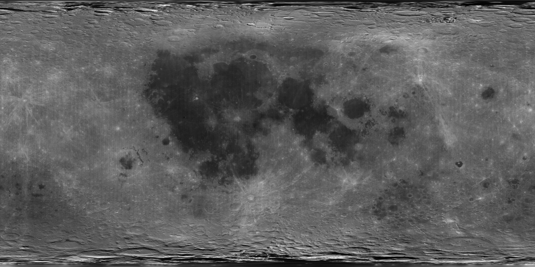
English: A global albedo map of the Moon obtained from the Clementine mission. The dark regions are the lunar maria, whereas the lighter regions are the highlands. The image is a cylindrical projection, with longitude increasing left to right from -180 E to 180 E and latitude decreasing from top to bottom from 90 N to 90 S. The center of the image corresponds to the mean sub-Earth point, 0 N and 0 E. |
| Bron | direct source found on here |
| Outeur | Image processing by the U.S. Geological Survey in Flagstaff, Arizona. |
Lisensiëring
This image is in the public domain in the United States because it only contains materials that originally came from the United States Geological Survey, an agency of the United States Department of the Interior. For more information, see the official USGS copyright policy.
|
Lêergeskiedenis
Klik op die datum/tyd om te sien hoe die lêer destyds gelyk het.
| Datum/Tyd | Duimnael | Dimensies | Gebruiker | Opmerking | |
|---|---|---|---|---|---|
| huidig | 10:39, 4 April 2007 | | 1 080 × 540 (204 KG) | Yonatanh | == Summary == {{Information |Description={{en|A global albedo map of the Moon obtained from the Clementine mission. The dark regions are the lunar maria, whereas the lighter regions are the highlands. The image is a cylindrical projection, with longitude |
Lêergebruik
Die volgende bladsy gebruik dié lêer:
Globale lêergebruik
Die volgende ander wiki's gebruik hierdie lêer:
- Gebruik in ba.wikibooks.org
- Gebruik in bn.wikibooks.org
- Gebruik in ca.wikipedia.org
- Gebruik in da.wikipedia.org
- Gebruik in en.wikipedia.org
- Gebruik in en.wikibooks.org
- Gebruik in es.wikipedia.org
- Gebruik in fi.wikipedia.org
- Gebruik in gl.wikipedia.org
- Gebruik in he.wikipedia.org
- Gebruik in ja.wikibooks.org
- Gebruik in ro.wikipedia.org
- Gebruik in sl.wikipedia.org
- Gebruik in sr.wikipedia.org
- Gebruik in ta.wikipedia.org
- Gebruik in zh.wikipedia.org