Lêer:Hurricane Katrina wind swath.gif
Oorspronklike lêer (895 × 716 piksels, lêergrootte: 29 KG, MIME-tipe: image/gif)
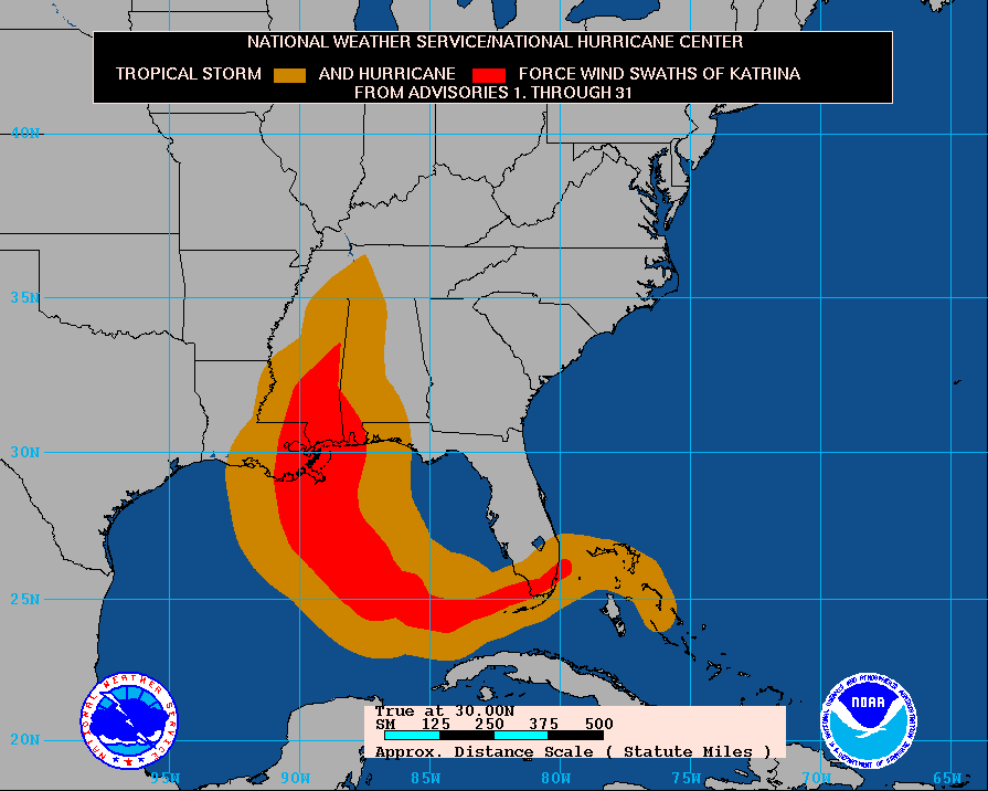
Tropical Storm KATRINA - Cumulative wind distribution
From data release #31 issued 10 AM CDT, 30 August, 2005 by National Hurricane Center Website
Opsomming
The path of Hurricane Katrina, obtained from http://www.nhc.noaa.gov/archive/2005/graphics/AT12/31.AL1205S.GIF
This display shows how the size of the storm has changed, and the areas potentially affected so far by sustained winds of tropical storm force (in orange) and hurricane force (in red). The display is based on the wind radii contained in the set of Forecast/Advisories indicated at the top of the figure. Users are reminded that the Forecast/Advisory wind radii represent the maximum possible extent of a given wind speed within particular quadrants around the tropical cyclone. As a result, not all locations falling within the orange or red swaths will have experienced sustained tropical storm or hurricane force winds, respectively.
Lisensiëring
This image is in the public domain because it contains materials that originally came from the U.S. National Oceanic and Atmospheric Administration, taken or made as part of an employee's official duties.
|
Lêergeskiedenis
Klik op die datum/tyd om te sien hoe die lêer destyds gelyk het.
| Datum/Tyd | Duimnael | Dimensies | Gebruiker | Opmerking | |
|---|---|---|---|---|---|
| huidig | 15:14, 3 September 2005 | | 895 × 716 (29 KG) | Square87~commonswiki |
Lêergebruik
Die volgende bladsy gebruik dié lêer:
Globale lêergebruik
Die volgende ander wiki's gebruik hierdie lêer:
- Gebruik in de.wikipedia.org
- Gebruik in en.wikipedia.org
- Gebruik in en.wikinews.org
- Gebruik in es.wikipedia.org
- Gebruik in ko.wikipedia.org
- Gebruik in nl.wikipedia.org
- Gebruik in uk.wikipedia.org