Lêer:Brazil State Maranhao.svg

Oorspronklike lêer (SVG-lêer, normaalweg 702 × 687 piksels, lêergrootte: 676 KG)

|
Standardization of derivative maps
Feel free to create derivations of this work, but if you want to illustrate a Wikipedia article with derivative works of this or similar maps of Brazil, please strictly follow the visual standard, nomenclature and classification already in use. All maps of Brazilian subdivisions are being adaptated or created in this way. We do not want to inhibit creativity but the pattern adopted here was presented and accepted by the Lusophone community and should be followed whenever possible. |
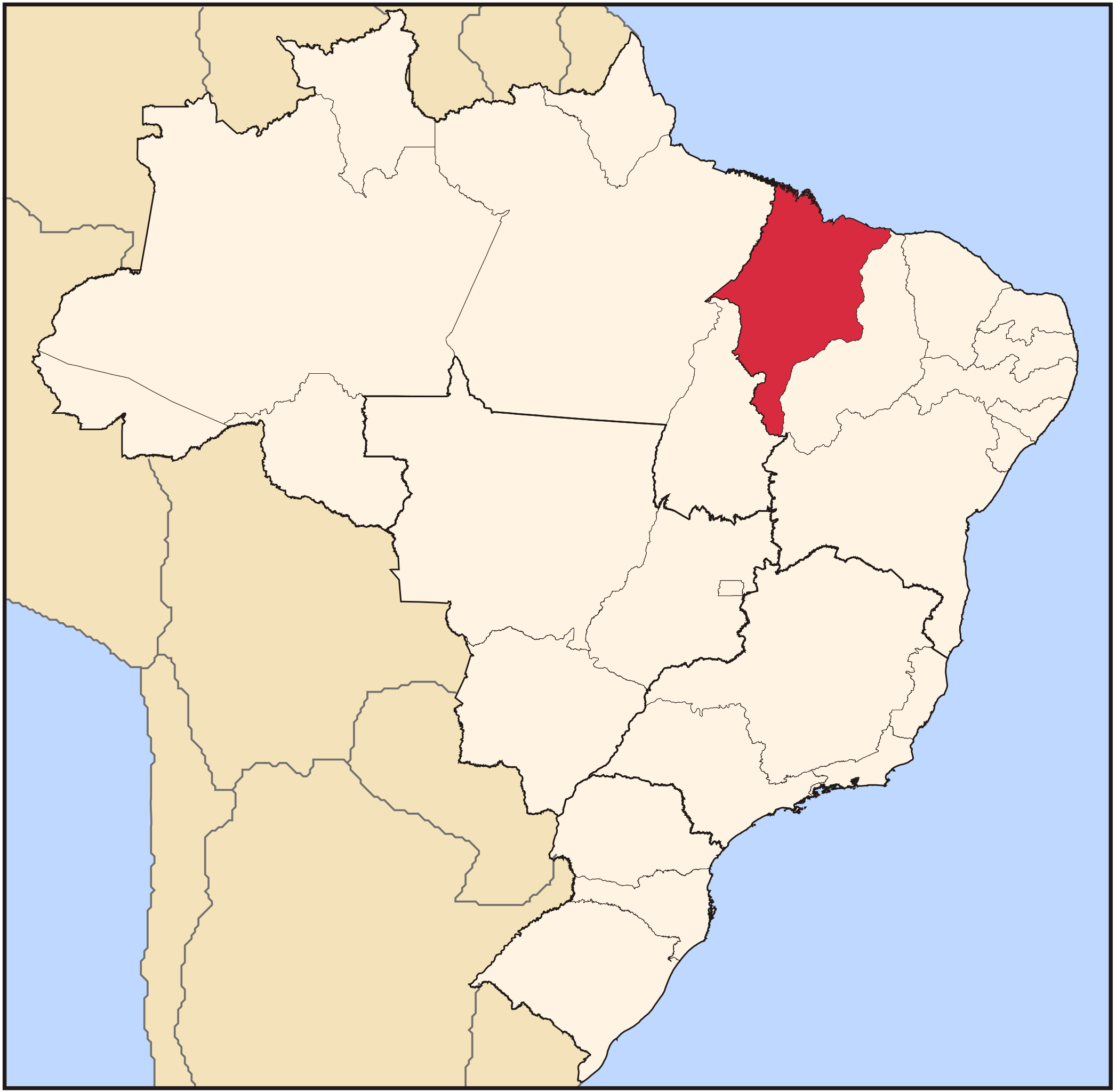
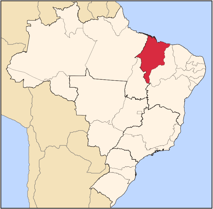
| Beskrywing | Map locator of Brazil's Maranhão state | ||||||||
| Datum | |||||||||
| Bron | Eie werk | ||||||||
| Outeur | Raphael Lorenzeto de Abreu | ||||||||
| Toestemming (Hergebruik van die lêer) |
Ek, die outeursreghouer van hierdie werk, publiseer dit onder die volgende lisensie:
This file is licensed under the Creative Commons Attribution 2.5 Generic license.
U kan die lisensie van u keuse kies. |

Lêergeskiedenis
Klik op die datum/tyd om te sien hoe die lêer destyds gelyk het.
| Datum/Tyd | Duimnael | Dimensies | Gebruiker | Opmerking | |
|---|---|---|---|---|---|
| huidig | 03:12, 3 Junie 2006 | | 702 × 687 (676 KG) | Raphael.lorenzeto | |
| 02:58, 22 April 2006 |  | 702 × 687 (448 KG) | Raphael.lorenzeto | {{Information| |Description=Map locator of Brazil's Maranhão state |Source=own work |Date=April, 21 2006 |Author=Raphael Lorenzeto de Abreu |Permission={{self2|GFDL|cc-by-2.5}} |other_versions= }} Category:Maps of Brazil |
Lêergebruik
Die volgende 2 bladsye gebruik dié lêer:
Globale lêergebruik
Die volgende ander wiki's gebruik hierdie lêer:
- Gebruik in ar.wikipedia.org
- Gebruik in bg.wikipedia.org
- Gebruik in bpy.wikipedia.org
- Gebruik in da.wikipedia.org
- Gebruik in de.wikipedia.org
- Gebruik in en.wikipedia.org
- Maranhão
- São Luís, Maranhão
- Alcântara, Maranhão
- Graça Aranha, Maranhão
- Imperatriz
- Balsas, Maranhão
- Bacabal
- Codó
- List of municipalities in Maranhão
- Cândido Mendes, Maranhão
- Governador Archer
- Luís Domingues
- Maranhãozinho
- Chapadinha
- Nova Iorque
- Jenipapo dos Vieiras
- Vargem Grande
- Açailândia
- Grajaú, Maranhão
- Morros
- Santo Antônio dos Lopes
- Wikipedia:WikiProject Brazil/Cartography
- Template:Municipalities of Maranhão
- Carutapera
- Coroatá
- Santa Inês
- Arame, Maranhão
- Barra do Corda
- Fernando Falcão
- Formosa da Serra Negra
- Itaipava do Grajaú
- Joselândia
- Santa Filomena do Maranhão
- Sítio Novo
- Tuntum
- Bernardo do Mearim
- Bom Lugar
- Esperantinópolis
- Igarapé Grande
- Lago do Junco
- Lago dos Rodrigues
Wys meer globale gebruik van die lêer.