Lêer:LocationReunion.svg

Size of this PNG preview of this SVG file: 800 × 398 piksels. Ander resolusies: 320 × 159 piksels | 640 × 318 piksels | 1 024 × 509 piksels | 1 280 × 636 piksels | 2 560 × 1 272 piksels | 998 × 496 piksels.
Oorspronklike lêer (SVG-lêer, normaalweg 998 × 496 piksels, lêergrootte: 4,15 MG)
Opsomming
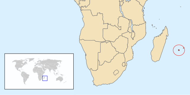
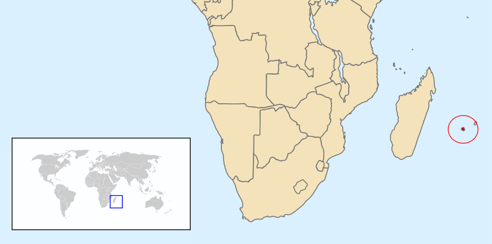
| Beskrywing | Map of Renunion based on Image:A large blank world map with oceans marked in blue.svg |
| Datum | |
| Bron | Eie werk |
| Outeur | Chris huh |
Lisensiëring
| Ek, die outeursreghouer van hierdie werk, stel dit hiermee in die publieke domein vry. Dit geld wêreldwyd. In sommige lande is dit dalk nie wettiglik moontlik nie. Indien so: Ek verleen aan enigiemand die reg om hierdie werk te gebruik vir enige doel, sonder voorwaardes, tensy sulke voorwaardes deur die wet vereis word. |
Lêergeskiedenis
Klik op die datum/tyd om te sien hoe die lêer destyds gelyk het.
| Datum/Tyd | Duimnael | Dimensies | Gebruiker | Opmerking | |
|---|---|---|---|---|---|
| huidig | 07:49, 12 Februarie 2013 | | 998 × 496 (4,15 MG) | Citypeek | removal border, clip |
| 21:06, 6 Mei 2008 |  | 1 000 × 500 (2,76 MG) | Chris huh | ||
| 21:00, 6 Mei 2008 |  | 1 000 × 500 (2,76 MG) | Chris huh | {{Information |Description=Map of Renunion based on Image:A large blank world map with oceans marked in blue.svg |Source=self-made |Date=6 May 2008 |Author= Chris huh |Permission= |other_versions= }} [[Category:Locator maps of cou |
Lêergebruik
Die volgende bladsy gebruik dié lêer:
Globale lêergebruik
Die volgende ander wiki's gebruik hierdie lêer:
- Gebruik in am.wikipedia.org
- Gebruik in ar.wikipedia.org
- Gebruik in ban.wikipedia.org
- Gebruik in bg.wikipedia.org
- Gebruik in bjn.wikipedia.org
- Gebruik in ca.wikipedia.org
- Gebruik in ceb.wikipedia.org
- Gebruik in cs.wikipedia.org
- Gebruik in en.wikipedia.org
- Gebruik in eo.wikipedia.org
- Gebruik in es.wikipedia.org
- Gebruik in et.wikipedia.org
- Gebruik in eu.wikipedia.org
- Gebruik in fa.wikipedia.org
- Gebruik in fr.wikipedia.org
- Gebruik in ha.wikipedia.org
- Gebruik in hif.wikipedia.org
- Gebruik in hu.wikipedia.org
- Gebruik in id.wikipedia.org
- Gebruik in it.wikipedia.org
- Gebruik in ka.wikipedia.org
- Gebruik in mk.wikipedia.org
- Gebruik in nl.wikipedia.org
- Gebruik in no.wikipedia.org
- Gebruik in pl.wikipedia.org
- Gebruik in pnb.wikipedia.org
- Gebruik in pt.wikipedia.org
Wys meer globale gebruik van die lêer.