Lêer:Map of USA AK full.svg

Size of this PNG preview of this SVG file: 800 × 560 piksels. Ander resolusies: 320 × 224 piksels | 640 × 448 piksels | 1 024 × 717 piksels | 1 280 × 896 piksels | 2 560 × 1 792 piksels.
Oorspronklike lêer (SVG-lêer, normaalweg 800 × 560 piksels, lêergrootte: 376 KG)
Opsomming
| Beskrywing |
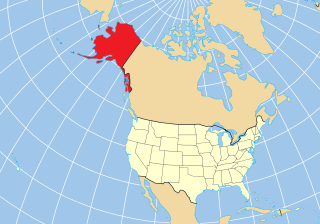
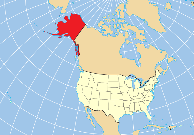
English: Map of the US state of Alaska relative to the rest of the country using a constant projection. A vector reproduction of Map of USA AK full.png based on the public domain location map from [1]. |
| Datum | |
| Bron | Eie werk |
| Outeur | skew-t |
Lisensiëring
| Ek, die outeursreghouer van hierdie werk, stel dit hiermee in die publieke domein vry. Dit geld wêreldwyd. In sommige lande is dit dalk nie wettiglik moontlik nie. Indien so: Ek verleen aan enigiemand die reg om hierdie werk te gebruik vir enige doel, sonder voorwaardes, tensy sulke voorwaardes deur die wet vereis word. |
Lêergeskiedenis
Klik op die datum/tyd om te sien hoe die lêer destyds gelyk het.
| Datum/Tyd | Duimnael | Dimensies | Gebruiker | Opmerking | |
|---|---|---|---|---|---|
| huidig | 20:54, 17 Desember 2012 | | 800 × 560 (376 KG) | Ras67 | black frame removed, basic size adjusted |
| 08:56, 26 Mei 2010 |  | 159 × 112 (377 KG) | Skew-t | {{Information |Description={{en|1=Map of the US state of Alaska relative to the rest of the country using a constant projection. A vector reproduction of Map of USA AK full.png based on the public domain location map from |
Lêergebruik
Die volgende bladsy gebruik dié lêer:
Globale lêergebruik
Die volgende ander wiki's gebruik hierdie lêer:
- Gebruik in bcl.wikipedia.org
- Gebruik in br.wikipedia.org
- Gebruik in ca.wikipedia.org
- Gebruik in en.wikipedia.org
- Gebruik in es.wikipedia.org
- Nome
- Hope (Alaska)
- North Pole
- Teller (Alaska)
- Akutan (Alaska)
- Cold Bay
- False Pass
- King Cove (Alaska)
- Sand Point (Alaska)
- Nelson Lagoon
- Belkofski
- Ikatan (Alaska)
- Morzhovoi
- Unga (Alaska)
- King Salmon
- Naknek
- South Naknek
- Anderson (Alaska)
- Cantwell (Alaska)
- Ferry (Alaska)
- Healy (Alaska)
- McKinley Park (Alaska)
- Clear (Alaska)
- Kantishna
- Suntrana (Alaska)
- College (Alaska)
- Base de la Fuerza Aérea Eielson
- Ester (Alaska)
- Fox (Alaska)
- Harding-Birch Lakes
- Moose Creek
- Pleasant Valley (Alaska)
- Salcha
- Two Rivers (Alaska)
- Chatanika (Alaska)
- Chena Hot Springs
- Portal:Alaska
- Portal:Alaska/Titular
- Covenant Life
- Haines (Alaska)
- Lutak
- Mosquito Lake (Alaska)
- Mud Bay (Alaska)
- Kachemak (Alaska)
- Seldovia (Alaska)
- Seward (Alaska)
Wys meer globale gebruik van die lêer.