Lêer:Map of the National Roads of South Africa with labels.svg

Size of this PNG preview of this SVG file: 684 × 599 piksels. Ander resolusies: 274 × 240 piksels | 548 × 480 piksels | 876 × 768 piksels | 1 168 × 1 024 piksels | 2 337 × 2 048 piksels | 809 × 709 piksels.
Oorspronklike lêer (SVG-lêer, normaalweg 809 × 709 piksels, lêergrootte: 547 KG)
Opsomming
| Beskrywing |
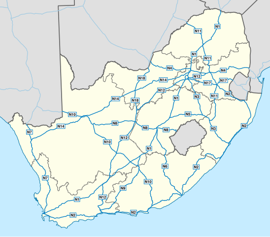
English: Map of South Africa showing the roads of the National Route System, with labels. |
| Datum | |
| Bron | Geodata from OpenStreetMap |
| Outeur | Htonl |
| Ander weergawes | File:Map of the National Roads of South Africa.svg, File:Map of the National Roads of South Africa with labels and cities.svg |
| SVG genesis |
Lisensiëring
Hierdie lêer is gelisensieer onder die Creative Commons Erkenning-Insgelyks Deel 3.0 Onoorgedraagde lisensie.
- U is vry:
- om te deel – die werk kopieer, versprei en deurgee
- om te hermeng – om die werk aan te pas
- Onder die volgende voorwaardes:
- naamsvermelding – U moet die nodige krediet gee, 'n skakel na die lisensie verskaf en aandui of daar veranderinge aangebring is. U mag dit op enige redelike manier doen, maar nie op enige manier wat daarop dui dat die lisensiegewer u of u gebruik onderskryf nie.
- insgelyks – As u die materiaal hermix, transformeer of voortbou, moet u u bydraes versprei onder die dieselfde of versoenbare lisensie as die oorspronklike.
| This work contains information from OpenStreetMap, which is made available under the Open Database License (ODbL).
The ODbL does not require any particular license for maps produced from ODbL data. Prior to 1 August 2020, map tiles produced by the OpenStreetMap Foundation were licensed under the CC-BY-SA-2.0 license. Maps produced by other people may be subject to other licences. |
Lêergeskiedenis
Klik op die datum/tyd om te sien hoe die lêer destyds gelyk het.
| Datum/Tyd | Duimnael | Dimensies | Gebruiker | Opmerking | |
|---|---|---|---|---|---|
| huidig | 18:45, 1 Februarie 2014 | | 809 × 709 (547 KG) | Htonl | update w/ simpler labels, roads in neighbouring countries, ODbL data |
| 19:51, 10 Desember 2010 |  | 757 × 660 (1,08 MG) | Htonl | use appropriate projection; change basemap style | |
| 03:19, 21 April 2010 |  | 1 000 × 786 (1,5 MG) | Htonl | minor SVG tweak | |
| 03:11, 21 April 2010 |  | 1 000 × 786 (1,5 MG) | Htonl | new version based on OSM data | |
| 21:26, 23 Julie 2009 |  | 1 000 × 786 (2,14 MG) | Htonl | minor tweaks | |
| 20:25, 23 Julie 2009 |  | 1 000 × 786 (2,13 MG) | Htonl | colours, labels, widths | |
| 18:05, 6 November 2008 |  | 1 000 × 786 (2,08 MG) | Htonl | {{Information |Description={{en|1=Map of South Africa showing the roads of the National Road System, with labels.}} |Source=Own work by uploader |Author=Htonl |Date=2008-11-06 |Permission= |other_versions=[[:Image:Map of the National Roads |
Lêergebruik
Die volgende 3 bladsye gebruik dié lêer:
Globale lêergebruik
Die volgende ander wiki's gebruik hierdie lêer:
- Gebruik in de.wikipedia.org
- Gebruik in en.wikipedia.org
- Gebruik in en.wikivoyage.org
- Gebruik in fr.wikipedia.org
- Gebruik in fy.wikipedia.org
- Gebruik in it.wikipedia.org
- Gebruik in ja.wikipedia.org
- Gebruik in nl.wikipedia.org
- Gebruik in ro.wikipedia.org
- Gebruik in uk.wikipedia.org
- Gebruik in zu.wikipedia.org