Lêer:Wfm bathurst island.jpg

Grootte van hierdie voorskou: 800 × 593 piksels. Ander resolusies: 320 × 237 piksels | 640 × 474 piksels | 1 024 × 758 piksels | 1 280 × 948 piksels.
Oorspronklike lêer (1 280 × 948 piksels, lêergrootte: 165 KG, MIME-tipe: image/jpeg)
Opsomming
| Beskrywing |
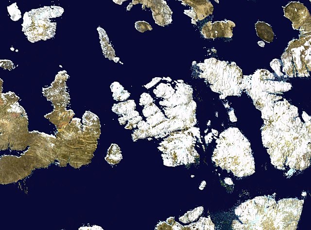
English: Bathurst Island in the Canadian arctic. ASA blue pearl data. |
| Datum | 9 April 2006 (upload date) |
| Bron | Satellite imagery taken by screenshot from NASA World Wind software |
| Outeur | NASA |
Lisensiëring
| This image is in the public domain because it is a screenshot from NASA’s globe software World Wind using a public domain layer, such as Blue Marble, MODIS, Landsat, SRTM, USGS or GLOBE.
|
 |
Lêergeskiedenis
Klik op die datum/tyd om te sien hoe die lêer destyds gelyk het.
| Datum/Tyd | Duimnael | Dimensies | Gebruiker | Opmerking | |
|---|---|---|---|---|---|
| huidig | 16:23, 9 April 2006 | | 1 280 × 948 (165 KG) | Finlay McWalter | Bathurst Island in the Canadian arctic. NASA blue pearl data, collecter using NASA World Wind. {{PD-USGov-NASA}} Category:Nunavut Category:Satellite images of islands Category:Satellite pictures of Canada |
Lêergebruik
Die volgende bladsy gebruik dié lêer:
Globale lêergebruik
Die volgende ander wiki's gebruik hierdie lêer:
- Gebruik in be.wikipedia.org
- Gebruik in bg.wikipedia.org
- Gebruik in ca.wikipedia.org
- Gebruik in ceb.wikipedia.org
- Gebruik in cy.wikipedia.org
- Gebruik in de.wikipedia.org
- Gebruik in el.wikipedia.org
- Gebruik in en.wikipedia.org
- Gebruik in en.wikiversity.org
- Gebruik in es.wikipedia.org
- Gebruik in et.wikipedia.org
- Gebruik in eu.wikipedia.org
- Gebruik in fa.wikipedia.org
- Gebruik in fr.wikipedia.org
- Gebruik in ga.wikipedia.org
- Gebruik in gl.wikipedia.org
- Gebruik in hu.wikipedia.org
- Gebruik in hy.wikipedia.org
- Gebruik in id.wikipedia.org
- Gebruik in it.wikipedia.org
- Gebruik in ja.wikipedia.org
- Gebruik in ka.wikipedia.org
- Gebruik in ko.wikipedia.org
- Gebruik in lt.wikipedia.org
- Gebruik in lv.wikipedia.org
- Gebruik in ml.wikipedia.org
- Gebruik in nl.wikipedia.org
- Gebruik in nn.wikipedia.org
- Gebruik in pl.wikipedia.org
- Gebruik in pt.wikipedia.org
- Gebruik in ro.wikipedia.org
- Gebruik in ru.wikipedia.org
- Gebruik in sl.wikipedia.org
- Gebruik in sw.wikipedia.org
- Gebruik in tt.wikipedia.org
- Gebruik in uk.wikipedia.org
- Gebruik in ur.wikipedia.org
- Gebruik in vi.wikipedia.org
- Gebruik in war.wikipedia.org
- Gebruik in www.wikidata.org
- Gebruik in zh.wikipedia.org