Lêer:Map of South Africa with Central Karoo highlighted (2011).svg

Size of this PNG preview of this SVG file: 684 × 599 piksels. Ander resolusies: 274 × 240 piksels | 548 × 480 piksels | 876 × 768 piksels | 1 168 × 1 024 piksels | 2 337 × 2 048 piksels | 809 × 709 piksels.
Oorspronklike lêer (SVG-lêer, normaalweg 809 × 709 piksels, lêergrootte: 498 KG)
.svg)
Opsomming
| Beskrywing |
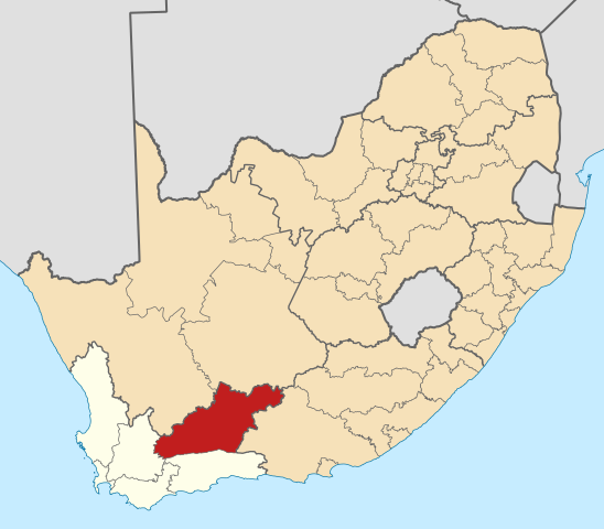
English: Map of district boundaries in South Africa, as they will be after the municipal elections of 18 May 2011, with the Central Karoo District Municipality highlighted in red within the Western Cape in yellow. |
| Datum | |
| Bron | Eie werk |
| Outeur | Htonl |
Lisensiëring
Ek, die outeursreghouer van hierdie werk, publiseer dit onder die volgende lisensie:

|
Toestemming word verleen tot die kopiëring, verspreiding en/of wysiging van hierdie dokument onder die voorwaardes van die GNU-lisensie vir vrye dokumentasie, weergawe 1.2 of enige latere weergawe uitgegee deur die Stigting vir Vrye Sagteware, sonder Invariante Dele, geen Voorbladtekste en geen Agterbladtekste. 'n Kopie van hierdie lisensie is ingesluit in die afdeling getiteld GNU Free Documentation License. |
This file is licensed under the Creative Commons Attribution-Share Alike 4.0 International, 3.0 Unported, 2.5 Generic, 2.0 Generic and 1.0 Generic license.
- U is vry:
- om te deel – die werk kopieer, versprei en deurgee
- om te hermeng – om die werk aan te pas
- Onder die volgende voorwaardes:
- naamsvermelding – U moet die nodige krediet gee, 'n skakel na die lisensie verskaf en aandui of daar veranderinge aangebring is. U mag dit op enige redelike manier doen, maar nie op enige manier wat daarop dui dat die lisensiegewer u of u gebruik onderskryf nie.
- insgelyks – As u die materiaal hermix, transformeer of voortbou, moet u u bydraes versprei onder die dieselfde of versoenbare lisensie as die oorspronklike.
U kan die lisensie van u keuse kies.
Lêergeskiedenis
Klik op die datum/tyd om te sien hoe die lêer destyds gelyk het.
| Datum/Tyd | Duimnael | Dimensies | Gebruiker | Opmerking | |
|---|---|---|---|---|---|
| huidig | 22:00, 2 Mei 2011 | | 809 × 709 (498 KG) | Htonl | == Summary == {{Information |Description ={{en|1=Map of district boundaries in South Africa, as they will be after the municipal elections of 18 May 2011, with the w:Central Karoo District Municipality |
Lêergebruik
Die volgende 15 bladsye gebruik dié lêer:
Globale lêergebruik
Die volgende ander wiki's gebruik hierdie lêer:
- Gebruik in bg.wikipedia.org
- Gebruik in ceb.wikipedia.org
- Gebruik in en.wikipedia.org
- Beaufort West Local Municipality
- Prince Albert Local Municipality
- Central Karoo District Municipality
- Laingsburg Local Municipality
- Merweville
- Nelspoort
- Laingsburg, South Africa
- Beaufort West
- Prince Albert, South Africa
- Template:Central Karoo District Municipality
- Matjiesfontein
- Murraysburg
- Leeu-Gamka
- Prince Albert Road
- Klaarstroom
- User:GerardM/Districts of South Africa
- Gebruik in fr.wikipedia.org
- Gebruik in ha.wikipedia.org
- Gebruik in id.wikipedia.org
- Gebruik in ig.wikipedia.org
- Gebruik in it.wikivoyage.org
- Gebruik in lv.wikipedia.org
- Gebruik in nso.wikipedia.org
- Gebruik in sw.wikipedia.org
- Gebruik in ts.wikipedia.org
Wys meer globale gebruik van die lêer.
.svg)
.svg)