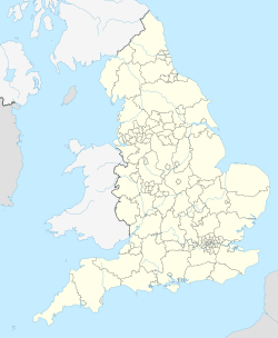
Gebruiker:Martinvl/Bournemouth-Christchurch-Poole
Bournemouth, Christchurch and Poole | |
|---|---|
Unitary Authority | |
| Koördinate: 50°43′22″N 1°52′55″W / 50.72278°N 1.88194°W | |
| Land | |
| Lande van die Verenigde Koninkryk | Engeland |
| Streeke van Engeland | South West England |
| Graafskappe van Engeland | Bournemouth-Christchurch-Poole |
| Oppervlak | |
| • Totaal | 161,3 km2 (62,3 vk. myl) |
| Bevolking | |
| • Totaal | 395 331[1] |
| • Digtheid | 2 450/km2 (6 300/vk. myl) |
| Tydsone | UTC+0 (UTC) |
| Poskode | BH |
| Skakelkodes | 01202 01425 |
| Webwerf | https://www.bcpcouncil.gov.uk/ |
Bournemouth-Christchurch-Poole is 'n Unitary Authority[Nota 1] op die Engelese Suidkus. Dit is in 2019 gestig en bevat die voormalige Unitary authority van Bournemouth, die voormalige unitary authority van Poole and die voormalige munisipalteit van Christchurch. Voor 1975 is Christchurch en Bournemouth gemeente in Hampshire terwyl Poole 'n gemeente in Dorset is. Tussen 1975 en 2019 is al drie gemeentes in Dorset.
Notas
wysig- ↑ 'n Unitary Authority het dieselfde magte as 'n graafskap, maar is nie in munisipaliteite verdeel nie. Dit bevat egter siviele gemeentes.
Verwysings
wysig- ↑ "BCP Council: Population". Bournemouth, Christchurch and Poole Council. Besoek op 28 Julie 2021.
